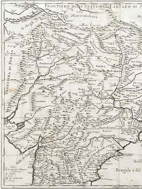
Map of Northern India

Map of Northern India

Pub. Rome by Giacomo Giovanni Rossi

Original engraved map

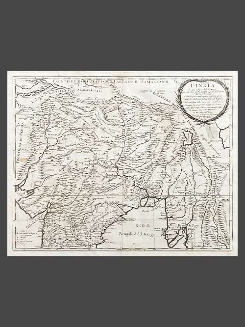
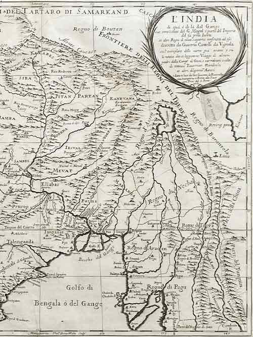
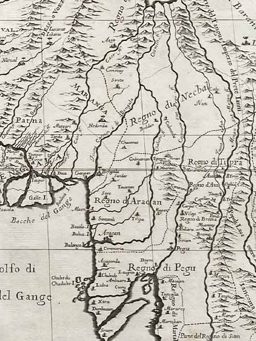
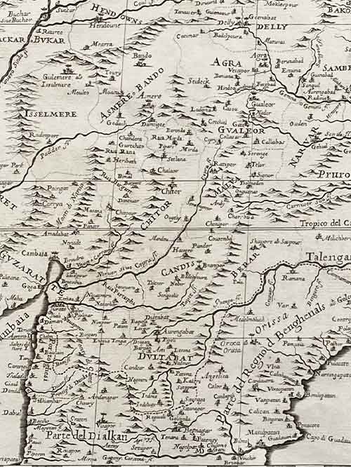
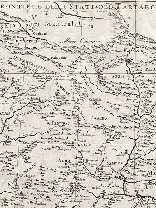
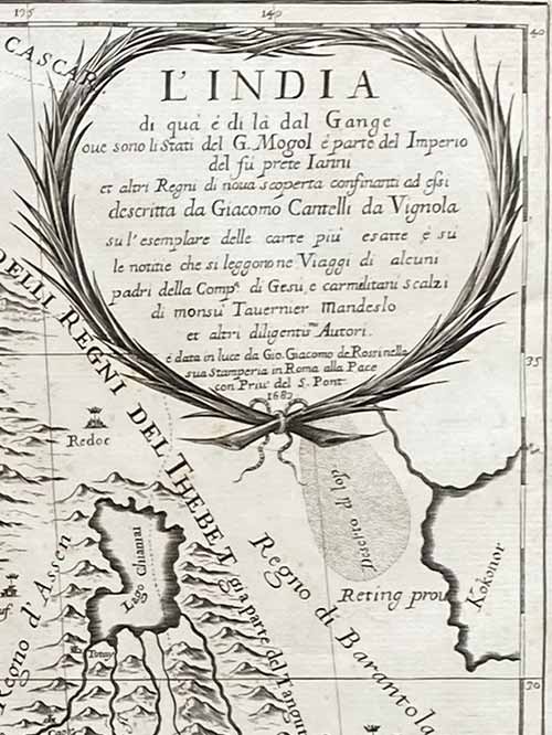
This is a fine representation of the Cantelli-Rossi map showcasing Northern India, Pakistan, Afghanistan, and Tibet. The map’s title includes a dedication to Jean-Baptiste Tavernier. It covers the northern frontier, reaching up to Cabul, Samarkand, Nupal, Boutan, and Lassa. Notably, the sources of the Indus and Ganges Rivers are accurately depicted on the map.

Cantelli (1643-1695), a geographer and cartographer from Montorsello near Vignola, began his journey in Bologna, where he pursued humanistic studies. In 1669, he became the secretary to Marquis Obizzo da Ferrara before traveling to Venice and eventually Paris. There, he established connections with prominent French geographers of the time, including Du Val, Nicola Sanson, and Michel Antoine Baudrand. Cantelli collaborated with the renowned De Rossi cartographic workshop, which published most of his maps. With a growing reputation as a skilled cartographer, Cantelli caught the attention of Pope Innocent XI and the Duke of Modena and Reggio Francesco II d’Este, both of whom sought him as their official cartographer. He chose to work for Francesco II and was appointed court geographer in November 1685. Over the following years, he produced numerous maps of European countries and territories. The majority of his maps were featured in the well-known Mercurio Geografico atlas, published in Rome by the De Rossi family.

Size (cms): 44(H) x 55(W)
Size (inches): 17.5(H) x 21.5(W)

Mounted Size (cms): 64(H) x 75(W)
Mounted Size (inches): 25(H) x 29.5(W)

SKU: PA-LM-4 Categories: , , Tag:

Description

Pub. Rome by Giacomo Giovanni Rossi

Original engraved map

This is a fine representation of the Cantelli-Rossi map showcasing Northern India, Pakistan, Afghanistan, and Tibet. The map’s title includes a dedication to Jean-Baptiste Tavernier. It covers the northern frontier, reaching up to Cabul, Samarkand, Nupal, Boutan, and Lassa. Notably, the sources of the Indus and Ganges Rivers are accurately depicted on the map.

Cantelli (1643-1695), a geographer and cartographer from Montorsello near Vignola, began his journey in Bologna, where he pursued humanistic studies. In 1669, he became the secretary to Marquis Obizzo da Ferrara before traveling to Venice and eventually Paris. There, he established connections with prominent French geographers of the time, including Du Val, Nicola Sanson, and Michel Antoine Baudrand. Cantelli collaborated with the renowned De Rossi cartographic workshop, which published most of his maps. With a growing reputation as a skilled cartographer, Cantelli caught the attention of Pope Innocent XI and the Duke of Modena and Reggio Francesco II d’Este, both of whom sought him as their official cartographer. He chose to work for Francesco II and was appointed court geographer in November 1685. Over the following years, he produced numerous maps of European countries and territories. The majority of his maps were featured in the well-known Mercurio Geografico atlas, published in Rome by the De Rossi family.

Size (cms): 44(H) x 55(W)
Size (inches): 17.5(H) x 21.5(W)

Mounted Size (cms): 64(H) x 75(W)
Mounted Size (inches): 25(H) x 29.5(W)
Additional information

Material

Paper

Title

Go to Top